Deutschandflug 2011 Touring Group - Complete Photo Log - Flight Simulator Version
The prestigious and traditional General Aviation Event organised by the Deutsche Aero Club (the primary German Organziation for General Aviation) was celebration the 100th anniversary, based on a tradition of such Events starting as early as 1911. (At that time a 1800km cross country flight starting and ending in Berlin)
"Deuschlandflug 2011" is an orientation ralley for aviators. A three-day Event held from July 7 to July 9 2011 starting from Hannover International Airport EDDV and leading to Oberschleissheim Airfield EDNX near Munich.
The Competition Group ("Wettbewerbsgruppe") with over 60 teams had a different route over Kamenz and Weiden, while the Touring Group flew the following legs:
All pictures are taken on a flight with an Evektor "Eurostar" in real time, real weather during the actual time of the real event in Flight Simulator 2004 with additional Scenery where available.
Leg1: EDDV Hannover - Marburg Schönstadt EDFN 100nm
Start Time 8:33 UTC
 |
| Deutschlandflug 2011 Start in Hannover EDDV Rwy. 09R |
More than 120 General Aviation Movements within two hours was a rarely seen peak load at the Hannover Airport, but is was perfectly organised. The entire south runway was practically reserved for the Deutschlandflug participants and a special controller on the alternate tower frequency 120.40 Mhz provided a perfect service.
Southbound Touring participants (true course to Marburg 196 degrees) turned downwind and followed the Whiskey route leaving the Hannover CTR.
 |
| DF2011 Leg1 Right Downwind Rwy 09R leaving CTR on Whiskey Route |
Orientation points in Hannover are the A2 Autobahn the Power plant to the left and the "Steinhuder Meer" lake right in front in the distance.
 |
| Leaving Hannover CTR on Whiskey Westbound |
|
 |
| Leine River and Mittellandkanal near Whiskey reporting point |
After leaving the Control Zone (CTR) we turned left on the original southbound course to Marburg.
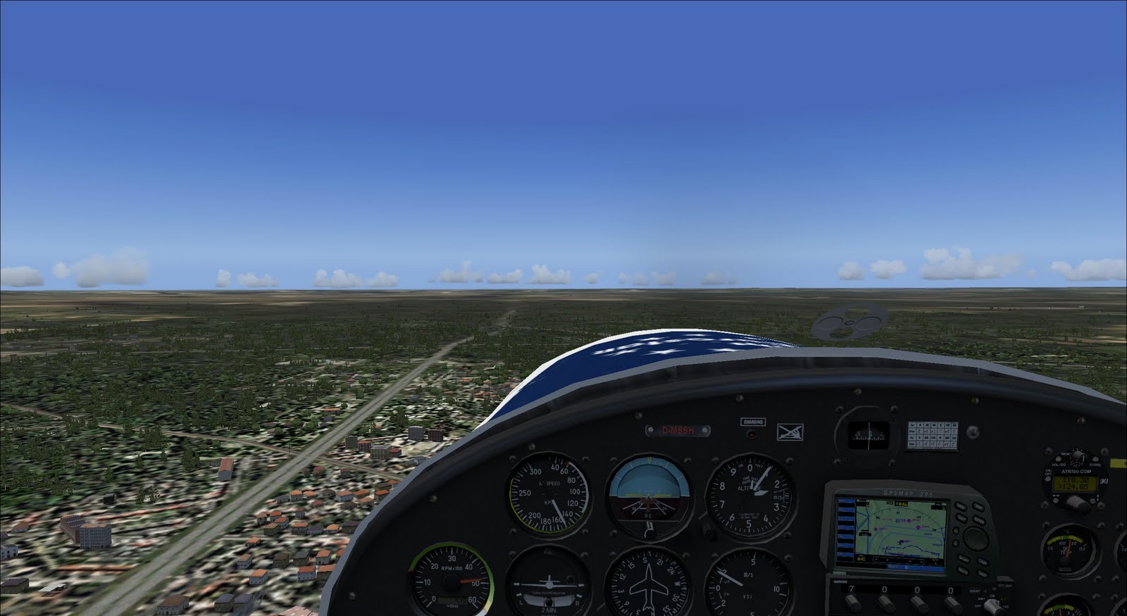
GPS was available but not used! The ethics of a true visual flight with terrestrial navigation dictate to try without. After passing the Deister Hills (Tower on the left) and crossing the "Süntel" Hills the city of Hameln was expected left.
 |
| Hameln and the Weser River as expected to the left |
The next checkpoint enroute was the city of Bad Pyrmont which was expected right flying over the Bad Pyrmont Airfield EDVW.
Both was indentified easily.
 |
| Bad Pyrmont right across |
 |
| EDVW Bad Pyrmont Airfield (FS standard scenery) |
The the weather got marginal and we were partially at or even slightly below the minimum safety height of 500ft. The city of Brakel positively identified and the next major Checkpoint and landmark was the Edersee lake which was expected to be crossed right in the middle.
We tried wind correction angles between 6-9 degrees based on the still easterly winds and hit Edersee perfectly in the middle.
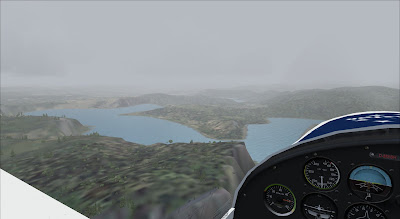 |
| Edersee lake |
 |
| Eurostar flying over Edersse (FS 2004 Std. Scenery) |
Not long after the Edersee Checkpoint we expected to spot the Marburg Airfield. A750m grass strip in 04/22 orientation. The 1700ft. traffic circuit is flown south east, so we joined right downwind on Runway 04 based wind 100 to 111 degrees.
 |
| EDFN Marburg Schönstadt Joing Right Downwind Rwy 04 |
|
 |
| Final approach to EDFN Marburg Runway 04 |
Final and landing in Marburg was fine despite the right crosswind component. The Eurostar LSA Aircraft has an officially demonstrated crosswind performance of (only!) 10kts but can handle more pilot with experience.
Touch down was at 9:55 UTC after 1h22
 |
| Final in Marburg - Freeware Addon Scenery | | |
|
|
|
 |
| Parked in Marburg |
The beautiful scenery has designed been designed by Joerg Dannenberg www.flightport.de
 |
| Fueling up in Marburg for Leg2 |
The lunch break in Marburg was used to fuel up and prepare
Leg2: EDFN Marburg - EDRG Idar-Oberstein 88.8nm TC 220 degrees
Start Time 11h45 UTC
 |
| City of Marburg southbound to Idar Oberstein |
We expect cross Autobahn A45 and pass the city of Wetzlar.
 |
| Wetzlar with river Lahn (Std. scenery) |
 |
| Enroute to Limburg |
After crossing the City of Limburg (with a major cathedral as checkpoint) and the A3 Autobahn we expected the next major landmark and spectacular sight:
Crossing the river Rhine at it´s most beautiful stretch between Wiesbaden and St. Goarshausen.
At 12:34 we reached the rhine and saw the Loreley Rock (a major landmark) to the right.
 |
| Loreley Rock at the Rhine River Valley |
 |
| View to the left along the Rhine River valley |
The FS Scenery can only partially portray the actual beauty of this landscape. Every 2000m or so medieval castles are mounted on the cliffs along the river.
We have another 30 minutes or to go until reaching the final destination for today: Idar-Oberstein.
Expecting a 650m grass strip in 06/24 orientation we joined right base on the north-west oriented traffic pattern for runway 24. The FS 20004 std. scenery wrongly features EDRG with an 11/29 orientiation(!).
The winds had changed south-westernly.
So we landed on runway 29 at 12:57 UTC (1h12 flight time) and parked overnight in Idar Oberstein.
 |
| Joing Final in Idar Oberstein |
 |
| Final in Idar Oberstein |
The next day: Friday July, 8th:
Leg3: EDRG Idar-Oberstein - ETEJ Bamberg
A longer distance (138.9nm) eastbound. The westernly winds meant tailwind and helped to shorten this longest leg of the tour.
We started at 8:23 UTC and turned left to an eastbound course (TC 84 degrees)
 |
| Climb from Runway 24 in Idar-Oberstein (cathedral on the left) |
We expected to cross the river Rhine again - but this time on a less spectacular stretch between Mannheim and Wiesbaden. The Rhein-Main Metro area (with it´s major airport and CTR) was avoided by passing alongside in the south.
We crossed Darmstadt and recognized the military airfield which is closed in reality but still usable and "active" in FS2004.
 |
| Closed Military American Airfield near Darmstadt |
|
The Kraftwerk / Power plant at the Main river near Elsenfeld was crossed at :08 minutes. We were surprised by the animated smoke effects, some (unknown) scenery must have provided the effects for this object.
 |
| Power plant enroute to Würzburg |
 |
| Crossing the Checkpoint |
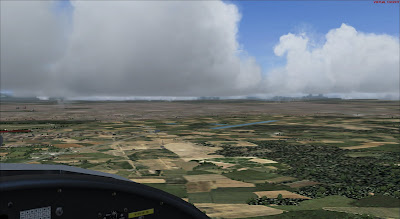
There were no spectacular sights on the rest of the flight. Wheather was beautifully clear. We crossed the River Main three times based on its turns between Würzburg and Bamberg. The river is only a poor creek in the standard scenery. Würzburg as visual checkpoint was reached at :26 minutes.
ETEJ in Bamberg is a military/civilian mixed airfield with a 1290m asphalt runway in the city. A northwest traffic pattern with a 04/22 orientation meant that runway 22 would be in use.
We planned to approach from north east to directly join right downwind Rwy.22.
 |
| Joining Final in Bamberg ETEJ Runway22 |
 |
| Military/Civilian City Airfield Bamberg Breitenau (Std. Scenery) |
Bamberg was the final destination for Friday.
The Final Leg for Deutschlandflug 2011:
Leg4 ETEJ Bamberg - EDNX Oberschleißheim
Start Time 8h20 UTC, Saturday July 9th
On this final leg to Oberschleißheim the Touring Group will join the Competition Group coming from Weiden at the airfield. The evening is reserved for the award ceremony.
On this route we had to cross Nürnberg CTR midfield and also Ingolstadt CTR. We decided to overfly the latter at 4000ft. and cross Nürnberg following the visual operation routes.
 |
| Midfield crossing of Nürnberg Airport EDDN |
 |
| City of Nürnberg to the right/southeast - Checkpoint EDDN at :42m |
In order to make no mistakes with the CTR the GPS was finally used. Vis/Ops defines vector tracks to enter and leave Nürnberg CTR. We left on a 140degree track soutbound to Foxtrott and the followed visually the A9 Autobahn to Ingolstadt.
 |
| Southbound along the A9 Autobahn |
Despite the explicet reccommendation to fuel up "full" at every location, I had not done so in Bamberg. Fuel was at 35% which should be ok for Oberschleissheim but did not provide a wide margin. Alongside the A9 we expected to see the Thalmässing Airfield EDPW and flew a low approach only to recognize that it was not open and/or did not provide fuel anyway.
So we continued to climb 4000ft. to overfly Ingolstadt CTR and happily recognized the first sight of the Alps Mountains in the far distance south.
 |
| Over Ingolstadt CTR with Alps in sight in the distance |
 |
| In 4000ft. over Ingolstadt - Zoom Photo of Munich and Alps Mountains |
Shortly after passing Ingolstadt we started a slow descent to 2800ft. the defined traffic pattern for Oberschleißheim EDNX. The latter is located at the edge of Munich CTR, clearance to enter for landing in Oberschleißheim can be assumed on certain weather minima which was no point at this beautiful Saturday.
Oberscheißheim Airfield is directly south of the Oberschleißheim Castle and park. The olympic regatta race track can also be seen widely so finding the field and joining the traffic pattern correctly was easy.
 |
| Castle Oberschleissheim and Airfield EDNX |
We approached from north and joined downwind for runway 08 (the wind was again south/easternly) and enjoyed the beautiful sights on this final approach based on the very nice freeware scenery from Dr. Falko Dienstbach.
 |
| Approaching Oberschleißheim from North |
 |
| Downwind Rwy 08 EDNX - Regatta track as orientation point |
 |
| Turing base in EDNX Oberschleissheim |
 |
| Turing final - approach for the asphalt strip |
 |
| Ending Deutschlandflug 2011 - The final approach |
Summing up at this point, the 100years anniversary edition Deutschlandflug 2011 was a great success. Partipants had fun, and the weather was above average all along the tracks for all three days.
My own flight education will be finished this summer, so that it is not unlikely to join the 101th version of this GA Event the next time in real life.
 |
| Final in Oberschleissheim |
 |
| Parking near the blimp - (Scenery from Dr. Falko Dienstbach) |
 |
| Parking spot with Museum Hangars and Castle in the background |


